


Tasmanian operational areas in detail
The following operational areas for recreational vessels are determined in the Marine and Safety (Limits of Operational Areas of Vessels) By-laws 2023.
Recreational vessels
Operational areas determine the minimum safety equipment required to be carried on a recreational vessel. Safety equipment differs depending on whether the vessel is operating in smooth waters, sheltered waters, or coastal waters.
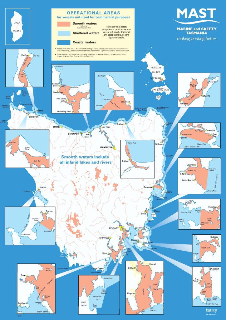
The MAST recreational vessel operational areas map clearly identifies these limits.
For the specific limits in a certain area:
Smooth waters
The geographical limits of the waters defined as smooth waters are specified in schedule 1 of the Marine and Safety (Limits of Operational Areas of Vessels) By-laws 2023.
Sheltered waters
Sheltered waters for recreational vessels (vessels not used for a commercial purpose) are within all waters defined as smooth waters, as well as waters within 2 nautical miles to seaward of the mainland coast of Tasmania between Cape Grim across the north coast and down the east coast to South East Cape. All Sheltered waters are specified in the Marine and Safety (Limits of Operational Areas) By-Laws 2023 – Clause 7 (a), (b), (c), (d) and (e).
Coastal waters
Coastal waters for recreational vessels refer to any waters to seaward of the limits of smooth and sheltered waters as defined above.
Commercial vessels
More information on all commercial vessel operational areas in Tasmania is available on this website,