M123-25(T) Lake Rosebery – Prohibited Area
Mariners are advised that due to ongoing oil spill recovery works, the Prohibited Area will be reduced in size starting at midnight on Friday, 21 February 2025.
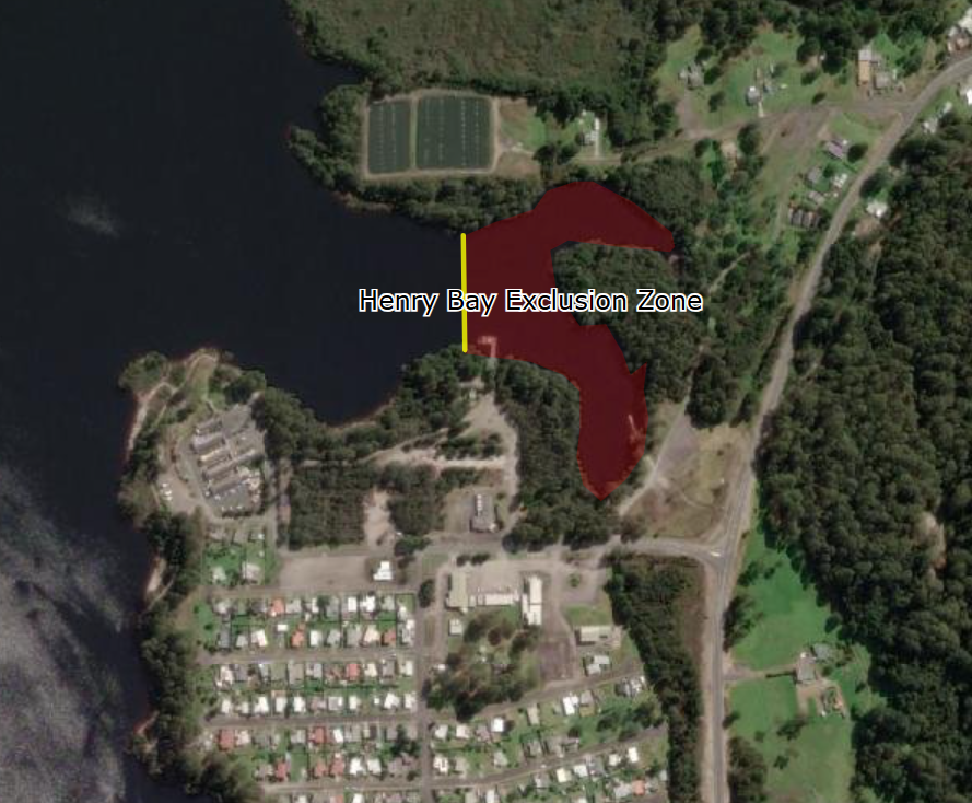
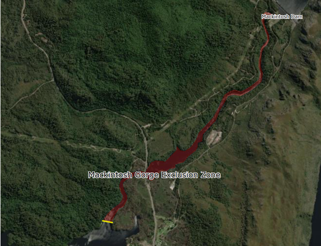
Two smaller prohibited areas will now exist. One encompasses all waters of the Mackintosh Gorge north of an imaginary line across the Mackintosh River from Latitude 41° 43.645’S to Longitude 145° 36.913’E up to the southern boundary of the standing Hydro Prohibited area south of the Mackintosh Dam. The second area is around the Henry Bay Boat Ramp within all waters east of an imaginary line drawn from Latitude 41° 44.124’S Longitude 145° 36.922’E to Latitude 41° 44.052’S Longitude 145° 36.927’E. The Prohibited area will remain in effect until cancelled.
The standing prohibited area that Hydro Tasmania has in place, which covers all waters south of the Mackintosh Dam for 2700 metres, remains in place for safety reasons and does not require oil spill clean-up.
All vessels, including lightweight craft, must not navigate within the prohibited area unless approval has been granted by the Environment Protection Authority (EPA) or Hydro Tasmania.
Regulation 71 of the Marine and Safety (Pilotage and Navigation) Regulations 2017 provides for the declaration of a specified area to be a prohibited area for other vessels or persons. A police officer may intercept and remove to a place of safety any vessel or person in a prohibited area.