M260-25(T) South West Bass Strait – Deployment of Scientific Research Buoys
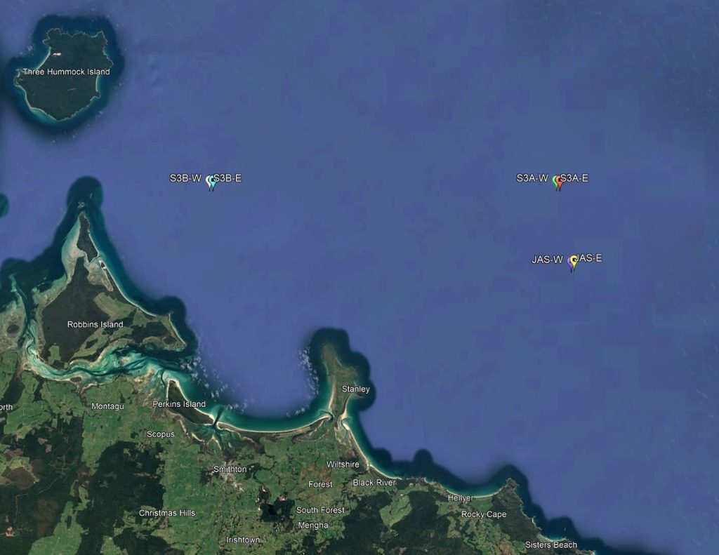
Mariners are advised that five IMOS surface buoys for satellite altimetry calibration and validation will be deployed within 0.1 nautical miles of the three locations below from Wednesday, 23 July 2025 until 15 September 2025.
Each buoy is lit by a flashing beacon (once every 3 seconds).
Buoy @ Location JAS-E: -40° 38.298’S 145° 35.460’E (WGS84) (North of Rocky Cape)
Buoy @ Location JAS-W: -40° 38.400’S 145° 35.220’E (WGS84) (North of Rocky Cape)
Buoy @ Location S3A-E: -40° 33.385′ S 145° 34.289′ E (WGS84) (North of Rocky Cape)
Buoy @ Location S3B-E: -40° 33.385′ S 145° 06.235′ E (WGS84) (East of Robbins Island)
Buoy @ Location S3B-W: -40° 33.385′ S 145° 05.955′ E (WGS84) (East of Robbins Island)
Vessels should transit the area with caution.