M373-22(T) Port of Devonport – Virtual Aids to Navigation
A Virtual Aid to Navigation (V.AtoN) has been established in the Port of Devonport in position, Latitude 41° 09.910’ S, Longitude 146° 22.094’ E. The Virtual Beacon is transmitting as a starboard hand.
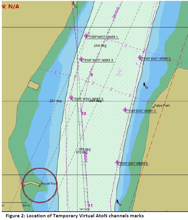
Six temporary Virtual Aids to Navigation have also been established within the channel to mark the extent of the channel declared at 7.8m. These temporary V.AtoNs identify a reduced width of the channel in this vicinity. The temporary V.AtoNs are in the following positions:
TEMP WEST INNER 1
Latitude 41° 10.427’ S, Longitude 146° 21.846’ E
Virtual Beacon, Starboard hand mark
TEMP WEST INNER 3
Latitude 41° 10.453’ S, Longitude 146° 21.839’ E
Virtual Beacon, Starboard hand mark
TEMP WEST INNER 5
Latitude 41° 10.496’ S, Longitude 146° 21.824’ E
Virtual Beacon, Starboard hand mark
TEMP WEST INNER 2
Latitude 41° 10.451’ S, Longitude 146° 21.927’ E
Virtual Beacon, Port hand mark
TEMP WEST INNER 4
Latitude 41° 10.510’ S, Longitude 146° 21.905’ E
Virtual Beacon, Port hand mark
TEMP WEST INNER 6
Latitude 41° 10.569’ S, Longitude 146° 21.893’ E
Virtual Beacon, Port hand mark