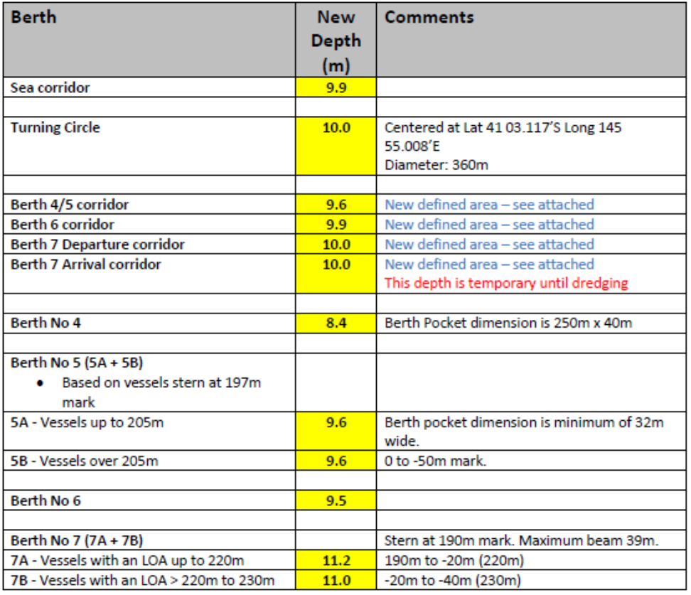
M377-23(T) Port of Burnie – Minimum Declared Depths
Following a hydrographic survey in the Port of Burnie, the following declared depths are now applicable.
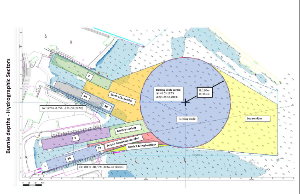
To assist with identification of declared depth areas within Burnie Harbour, and referencing the attached diagram, sectors have been described as follows:
• General Berth Pockets
• Berth Pockets segmented for larger vessels are noted by way of Additional Areas extending the Berth Pockets
• The Burnie ‘Turning Circle’ centre has been determined as Latitude 41° 3.117’S, Longitude 145° 55.008’E, which gives a radius of 180m and a diameter of 360m, with a least depth of 10.0m.
• Sea corridor is from open water to the Inner Turning Circle.
• Passages connecting Berth Pockets to the Inner Turning Circle are referred to as corridors, refer to the attached diagram.
• This information will be uploaded to the Australian Hydrographic Office and subsequently defined on the nautical charts.
M318-23 is now cancelled.