Heading east there are some great anchorages in the Rubicon Estuary – a great place for cruising in smaller boats.
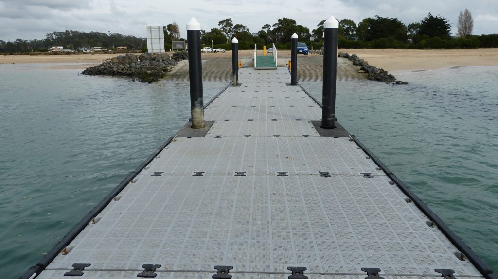
The boat ramp at Port Sorell (Chart: AUS 799) allows for easy access, and upstream around Eagle Point, the holding is excellent. There is also a concrete pontoon which is suitable for larger boats to lie alongside, a few hundred metres west of the boat ramp. The tide is strong, so you will need adequate springs and lines.
If arriving into the Tamar, the Low Head pilot station is a popular spot. Here a pontoon enables you to lie alongside.
Further upriver at George Town, all services are available, and there is also a pontoon to lie alongside if provisions are needed. On the western side of the Tamar at Beauty Point, fuel is available at the Port Dalrymple Yacht Club, email pdyc@bigpond.com.au or phone 0437 072 181 for diesel.
Berthing may also be available at the Tamar Yacht Club marina; please email office@tyc.asn.au or phone 0418 321 339. A hotel serving meals is close by. Both clubs have slipway facilities.
A trip up the river from Low Head or Beauty Point is a fantastic way to fill in a day. There are many pontoons recently re-decked by MAST which dot the River Tamar (Charts: AUS 167 & 168) to allow you to go ashore, whether it is for lunch at Rosevears or to visit one of the many wineries.
At West Arm there is a great anchorage, pontoon and picnic area. You can cruise in company then go ashore for a BBQ. A great weekend getaway on any sized boat!
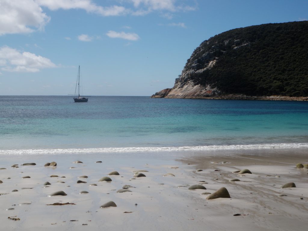
Spring Bay and Sheep Tail point are popular cruising anchorages further upriver, just north of the Batman Bridge on the western side of the river.
In Launceston (affected by low tides) your best contact is the Tamar Yacht Club who have a slipway available and berths alongside.
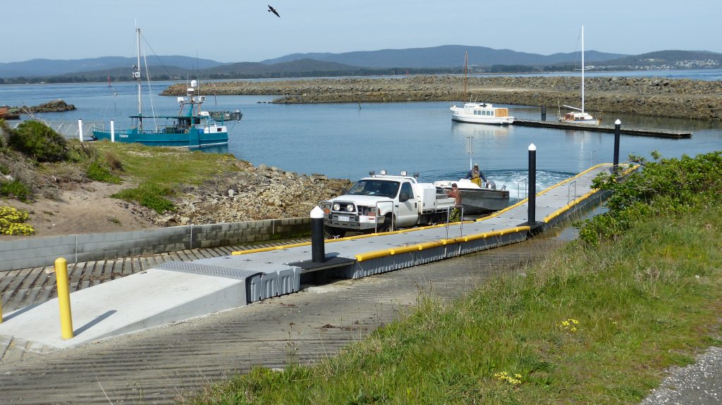
Trailer boats on the Tamar are well catered for, especially on the West Tamar. Ramps are found at regular intervals and all have been upgraded by MAST over recent years. Starting at the mouth of the Tamar, there is a great ramp and pontoon at Low Head on the eastern side of the river. Another ramp is located further upstream on the eastern side, near George Town. On the western side of the river, there are good ramps with adequate parking at Kelso, Clarence Point and Beauty Point. Both ramps are serviced by pontoons. Further upstream, there is a good ramp at Devils Elbow (Sidmouth) and further upstream again at Gravelly Beach. The main ramp in the Launceston area is at the Tailrace, which is serviced with two ramps and a concrete pontoon. The upper Tamar region is best explored at high tide.
Heading east from the Tamar with a trailer boat, there is now great access at Weymouth, and the fishing is good; however, no services are available, so be sure to fuel up before arrival. There is a single-lane ramp and a concrete walkway, making it ideal in offshore winds. Best to launch an hour either side of low tide to ensure it’s 6m or more.
Bridport is another destination for trailer boats and the town has all services. This is a good departure point if heading to Waterhouse or perhaps further afield to Flinders Island.
Between Waterhouse and Musselroe, on the far North East of Tasmania, there is a nice anchorage called Foster Inlet. The Inlet is shallow inshore. Be sure to take into account the tidal range before dropping the anchor. The following drone footage refers.
For slightly larger trailer boats, a trip to Musselroe Bay and then a hop of 14.5 nm to Clarke Island and the Flinders Group is a must in the right weather. Banks Strait can be extremely dangerous in certain conditions, as can the fast-running tides around the Furneaux Islands.
Flinders Island (Chart 800) is magnificent, however it is an area where you need to have done some planning and have spoken to someone who has knowledge of the area prior to heading there. Throughout the area, there is a rise and fall in tide greater than that of the east coast of Tasmania. The strong tidal flows can create overfalls and rips in many areas. Ribbon weed can also make anchoring in some areas difficult. When selecting an anchorage for the night, try and ensure you have an understanding of the weather. Moving at night in some areas of Flinders Island can be extremely difficult and dangerous due to tides and the numerous rocks.
A really popular anchorage is at Preservation Island which is between Cape Barren and Clarke Island. The western side of “Preso” is a good anchorage in NE around to SE winds.
If you require fuel, Lady Barron is the only place at all tides. It is again recommended that you only approach Lady Barron during daylight. There are many places to explore, such as Clarke Island, Babel Island and further north at The Sisters. Fishing is good around Flinders Island, but be sure to research the size and bag limits.
There are two public cruising moorings at Lady Barron – MAST PM9 and MAST PM10.
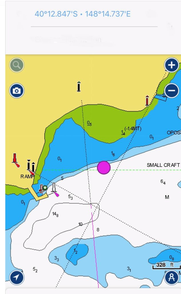
Navigation Warning, Sunken Vessel – Lady Barron
Please note that a vessel has sunk in the location shown below, highlighted by the pink dot. If approaching the wharf at Lady Barron, be aware of the position in relation to the sunken vessel.
To get fuel you will need to lie alongside the Tasports wharf. The contact is Michael Withers 0418 524 147.
There are many great anchorages around Flinders Island.
MAST has produced a number of videos showing the most popular anchorages. It is recommended you view these videos and use in conjunction with the appropriate printed cruising guide.
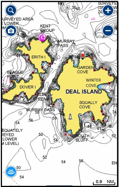
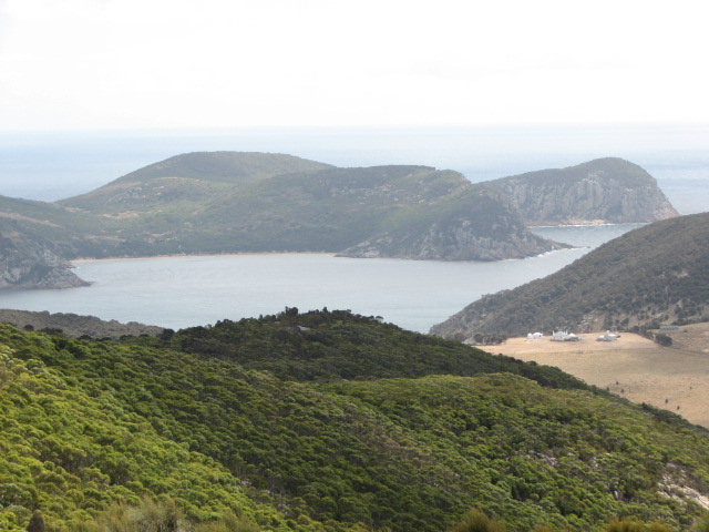
If heading to the Kent Group(Chart: AUS 148), then Deal Island and Erith Island are must-sees. There are some magical anchorages in this area, with scenery comparable to that of the Schouten and Hunter group areas. Be careful, however, as the passage between Deal Island, Erith Island and Dover Island can be very dangerous. Strong winds against the tide can make the entry into Murray Pass very rough at both ends.
Winter Cove on the eastern side of Deal Island gives good protection from westerly weather, however it is not unusual to have an easterly roll affect the anchorage. The wind also tends to funnel down the hills in squirts.
East Cove at Deal Island is a great anchorage in easterly weather. Ensure you find the sand patch NNE of the old jetty. A short walk up the hill will see you at the museum and the caretaker’s cottage. A 40-minute walk to the lighthouse is a good way to exercise after a few days on the boat, but be sure to pick the key up from the caretaker’s cottage as the views from the historic lighthouse are fabulous.
Garden Cove is also a great anchorage in southerly to southwesterly weather. The anchorage at West Cove on Erith Island, particularly in westerly weather, has seen many boats drag. Many seem to anchor along the beach; however, the safest anchorage in westerly weather at Erith Island is under the “sandblow” at the southern end of the beach off the rock platform.
HF coverage is available to Tamar Sea Rescue from Deal Island.
Must sees:
- Anchorages at Deal Island and Erith Island
- View from lighthouse at Deal Island
- Preservation Island
- The Sisters – Northern end of Flinders
Cruising the Flinders region and even to Deal Island in a trailable boat is possible in the right weather. The only place to access fuel would be Lady Barron or at Whitemark with a trailer boat. Additionally, MAST would not recommend this trip in anything under 6.5m, and your planning would need to be spot on, in the right weather pattern, and in company with other boats.
Late summer or early spring would be the best time to plan a trip. It is also possible to ship your car and boat to Flinders Island on the ferry out of Bridport; that way, you could tow your boat north to the Palana ramp and head out to the Sisters in the right weather.