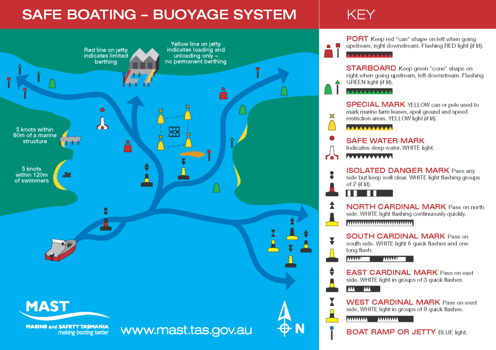
Location of Marks
The location of marks can be found on the MAST GIS.
Types of Marks
- Lateral Marks – indicate the edge of a channel
- Cardinal Marks – indicate the position of a hazard and the direction of safe water
- Isolated Danger Marks – indicate a hazard to shipping
- Safe Water Marks – indicate the end of a channel and deep, safe water is ahead
- Special Marks – indicate an area or feature such as speed restrictions or mooring area
Take time to study a chart and buoyage to familiarise yourself with the navigation channel. For further information on safe navigation see the IALA website.
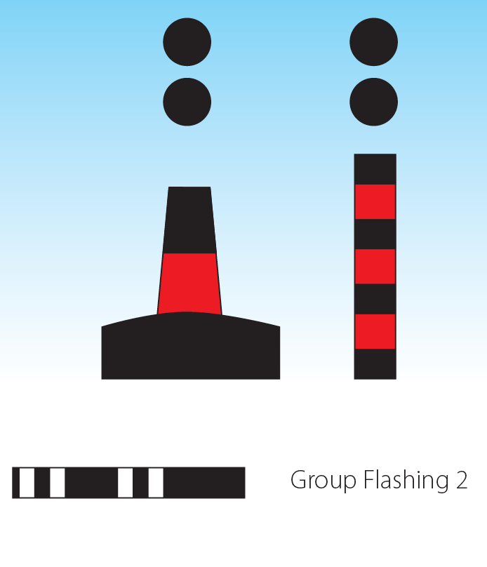
Lateral Marks
Port and starboard marks are referred to as lateral marks. Port hand marks are painted red and have a can-shaped top mark or buoy. If lit, a port hand mark shows a flashing red light.
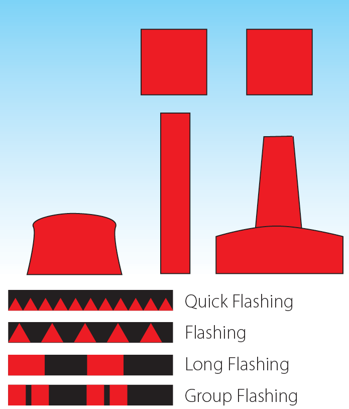
a red flashing light (when lit).
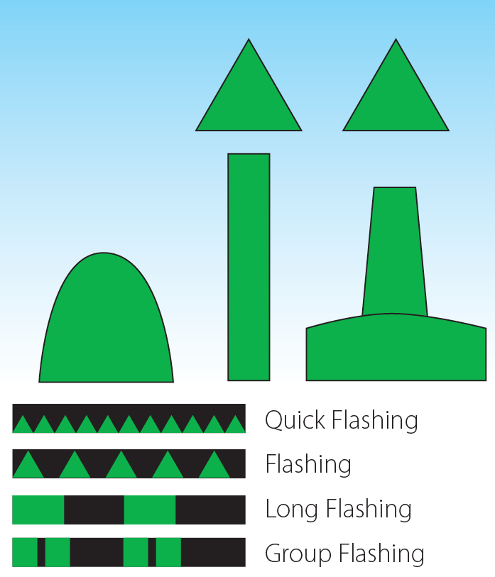
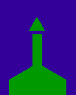
Starboard hand marks are painted green and have a cone-shaped top mark or buoy. If lit, a starboard hand mark shows a flashing green light. When both a port and starboard hand mark are placed near to each other you travel between the two of them.
Single Lateral Marks
Often lateral marks are not placed in pairs, so you will need to decide on the safe side to pass. The safe side to pass a lateral navigation marker is determined by your direction of travel to or from the sea.
The coming in and going out rule
Upon entering harbour the port (red) mark should be passed on the boat’s port (left) side, while the starboard (green) mark should be passed on the boat’s starboard (right) side.
When leaving harbour the port (red) mark should be passed on the boat’s starboard (right) side, while the starboard (green) mark should be passed on the boat’s port (left) side.

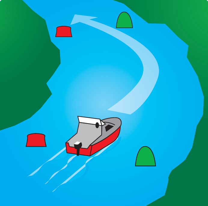
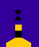
Lead Marks
Lead marks are a method used to define the correct course to be steered when in waters containing navigation hazards. They are often used to mark the correct approach to a navigation channel, which is then defined by lateral marks. The lead marks are two separate navigation aids (one in the foreground and one placed further back on the shore) which, when aligned, provide the correct course for the vessel to steer. Lead marks may be day marks or may be lit for night use.
The day marks are normally two triangles. To steer the correct course the boat should be manoeuvred so that the apex (point) of each triangle comes into alignment.
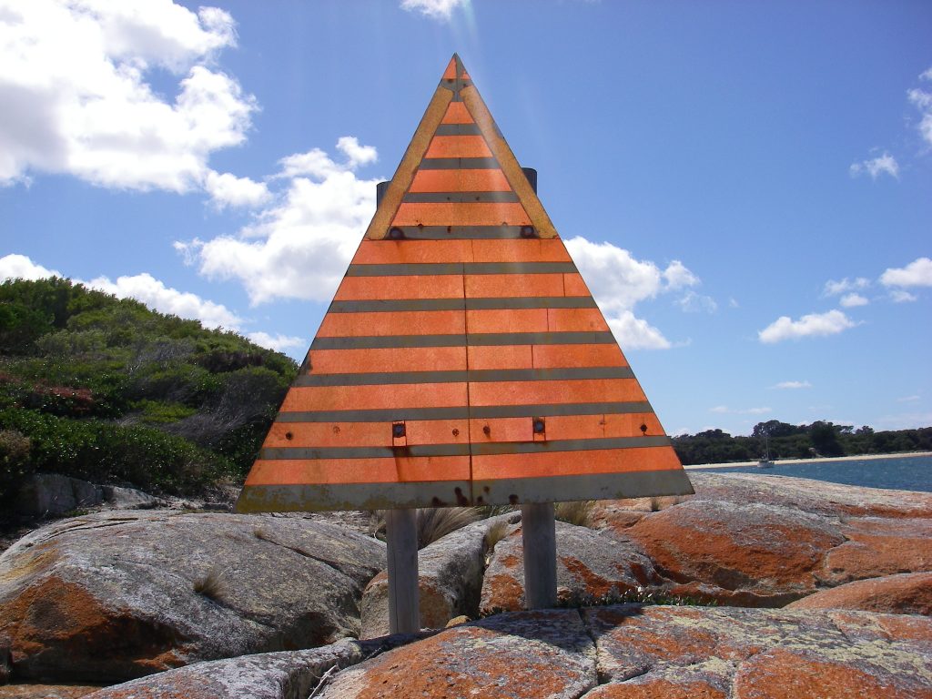
Isolated Danger Marks
These marks indicate dangers of limited extent with navigable waters all around them. You can pass them on any side, but do not pass too close. If lit, it shows a white light flashing in groups of two.
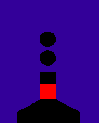
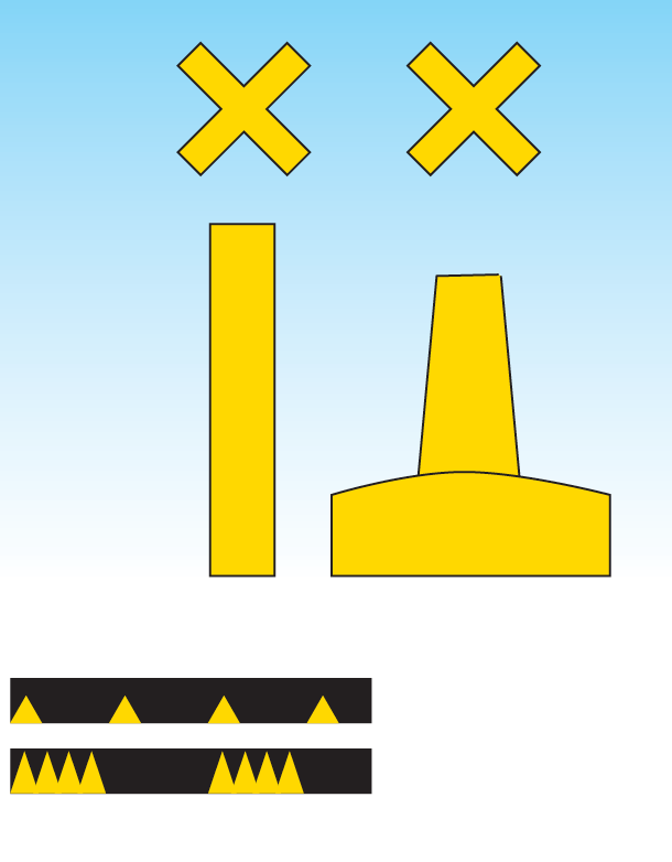
Special Marks
Special marks are yellow and indicate special features or areas such as tide poles, spoil grounds or underwater pipes. They are more commonly used in Tasmania to highlight fish farm boundaries. These farms vary in appearance and include fish cages, submerged lines and oyster racks. They all pose a hazard to navigation if vessels enter the farm perimeter. Marine farm navigation marks may be lit or unlit depending on the situation, but when lit, they show a yellow light.
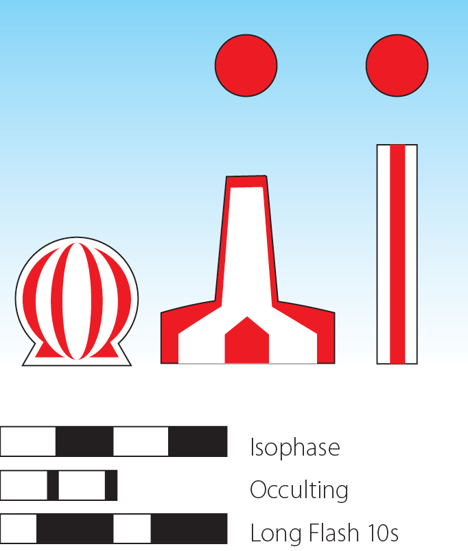
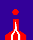
Safe Water Marks
These are not common in Tasmania.
However, they may be used to mark areas for commercial shipping. They show a white light at night and can be passed on any side.
Overhead Power Lines
Clearance heights vary with water level. It is most important that you know the height of your mast and understand the height level given on any sign. Clearance of power lines is usually given as the clearance above MHWS (Mean High Water Spring or the average of very high tides). This height may reduce during king tides or floods. Extra caution is required when launching/retrieving vessels with a mast. Always keep a lookout for overhead power lines, especially if you have rigged near a boat ramp and are trailering the boat to the ramp.
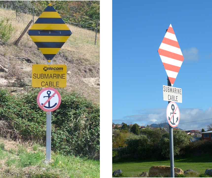
Submarine Cables
Anchoring is prohibited near submarine cables. If an anchor becomes snagged near one of these signs, it should NOT be retrieved – cut the line.
Cardinal Marks
Cardinal marks are used to indicate that deeper water lies in a compass direction away from a danger such as a reef and shallow areas.
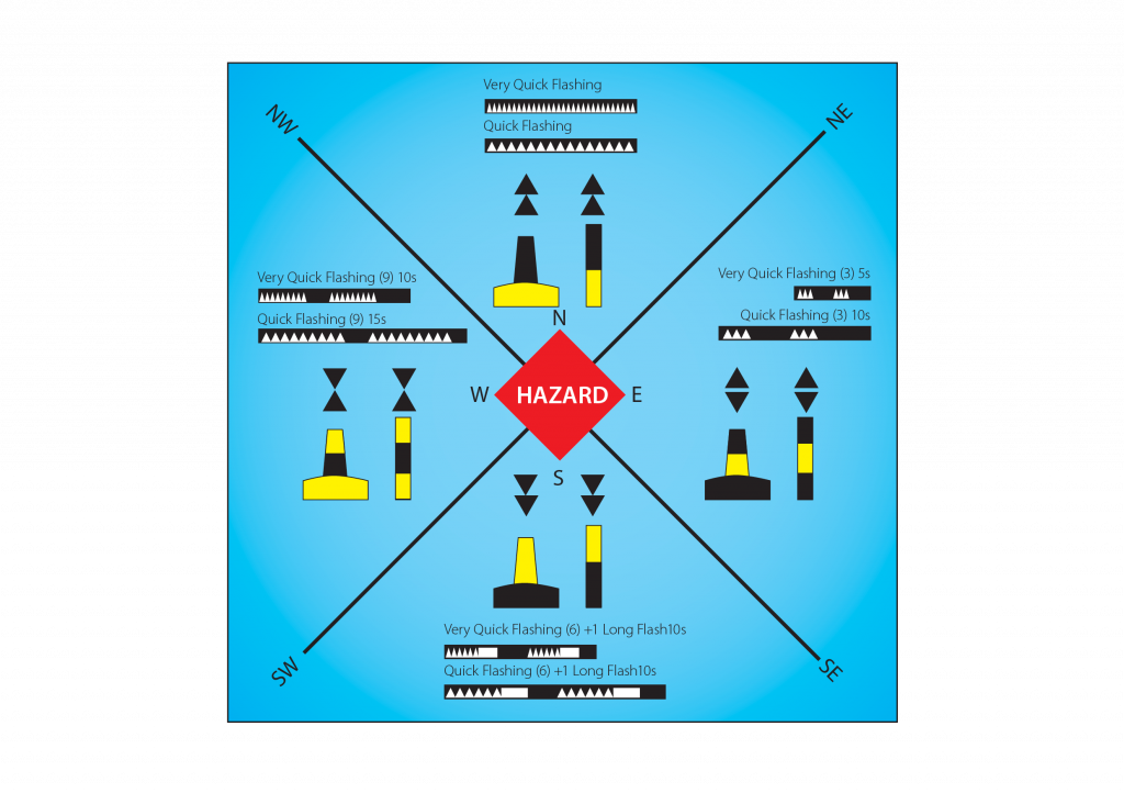
North Cardinal Mark
North cardinal marks show there is safe water to the North of the mark.The top cones point up or North.

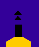
flashes quickly or very quickly
and continuously.
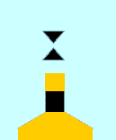
East Cardinal Mark
East cardinal marks show there is safe water to the East of the mark. The top cones are in the shape of an egg. To remember this, think of ‘E’ for egg and for East.
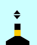
South Cardinal Mark
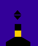
South cardinal marks show there is safe water to the South of the mark. The top cones point down or South.
quickly or very quickly 6 times
followed by a long flash every
10 or 15 seconds.
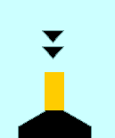
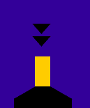
West Cardinal Mark
West cardinal marks show there is safe water to the West of the mark. The top cones make the shape of a wine glass. To remember this, think of ‘W’ for wine glass and for West.
flashes quickly or very
quickly 9 times every
10 or 15 seconds.
Copyright State of Queensland
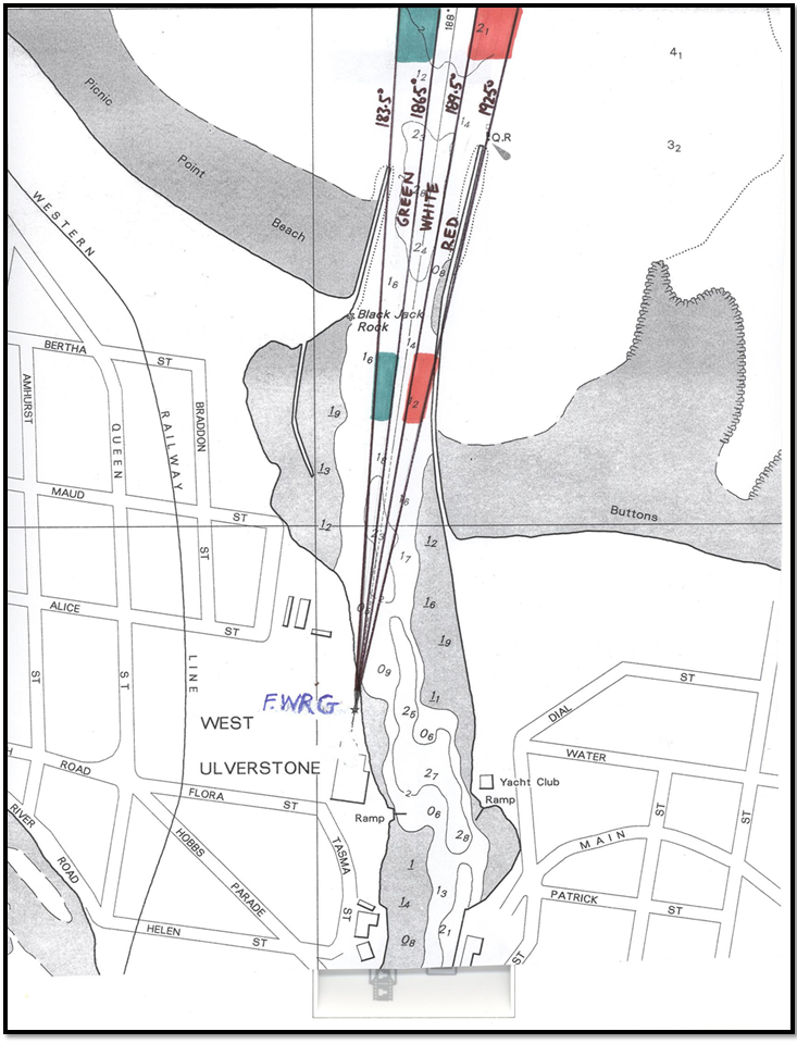
Guide to Ulverstone Leading Lights
The chartlet shows the new sector lights established as a leading line into the Leven River. The sector lights operate day and night and have a day range of 0.85nm which is well beyond the training walls. An orange dayboard has been established on the structure so mariners can more easily identify the lights during daytime operations.
Upon approaching the river entrance, mariners should remain on a course so that the white light remains visible which indicates that they are tracking on the leading line. When the observed light changes from white to green, the vessel is West of the leading line and a course alteration should be made. When the observed light changes from white to red, the vessel is East of the leading line and a course alteration should be made.
Buoyage System
MAST has produced the Safe Boating – Buoyage System sticker
These can be obtained from MAST or your local marine dealer.